- Boat Insurance
- Boat Browser
- Boating Courses
- Boat Registration
- Boating License
-
Boating Safety
Equipment
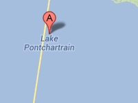
| Lake Pontchartrain Lake Pontchartrain borders the north boundary of New Orleans in Louisiana, and it is the largest of the three lakes that constitute the Pontchartrain Basin. Lake Maurepas is separated from Lake Pontchartrain by a land bridge, and a brackish marsh separates Lake Pontchartrain from Lake Borgne. All total, these lakes create almost 500,000 acres of wetlands that consist of fresh, intermediate, brackish, and saline marsh, including 215,600 acres of cypress swamp. Not a true lake, Lake Pontchartrain is an estuary that is connected to the Gulf of Mexico by the Rigolets strait and Chef Menteur Pass into Lake Borgne. Lake Pontchartrain contains over 38,000 surface acres, and about 3,200 acres are open waters. Lake Pontchartrain is an active lake for all types of water recreation. Although it is shallow in some parts, depths can reach from 20-30 feet in open areas. Wildlife is prevalent, despite the lake's urban surroundings. Many wildlife preserves surround this lake and New Orleans. If you're into fishing, pleasure boating, or just want to be around the excitement in New Orleans and the Gulf of Mexico, this could be the body of water for you. Fishing Between 2000 and 2009, the Lake Ponchartrain and Basin Foundation created nine artificial reefs in the Jefferson Parish portion of the lake. To date, they've documented over 50 species of crabs, shrimp, fish, and clams at these sites near Bonnabel Boat Launch and Williams Boat Launch. Word is that speckled trout in the 19-inch range love the shrimp that gather at these artificial reefs. |
Search Lake Pontchartrain Resources |
| Boating Although boaters might have a difficult time finding a public boat ramp on Lake Pontchartrain, they won't have difficulty finding a marina. Approximately 30 marinas dot this lake's shores, offering everything from full- to minimal-service launches and shops. One ramp is available at the Bonnabel Boat Launch and Park in Metairie on the south shore. A variety of boats share these waters and residents live along the shores. Although each parish maintains its own no wake zone regulations (signs are visible), it's common courtesy to limit your wake when around boat slips, docks, and shorelines on this lake. |
|
Lodging With its proximity to New Orleans and other urban towns, visitors have no problem finding lodging when visiting Lake Pontchartrain. Campers can enjoy a state park located near Mandeville on the north shore. Fontainebleau State Park maintains cabins and over 150 camp sites that range from primitive to pull-through sites with water, electric, and sewer. This park is easily reachable from I-10 east or west or from New Orleans in the south via the Lake Pontchartrain Causeway from Metairie to Mandeville. Other private campgrounds surround the lake, and accommodations such as cabins, short-term rentals, hotels, and inns also are available. Review the Lake Resource Guide for additional lodging. Communities Lake Pontchartrain is located in parts of St. Tammany, Orleans, Jefferson, St. John the Baptist, St. Charles, and Tangipahoa parishes in Louisiana on the north side of New Orleans. New Orleans is home to Louis Armstrong New Orleans International Airport in Jefferson Parish. Other towns surrounding Lake Pontchartrain include Slidell, Eden Isle, Lacombe, Mandeville and Covington, and Laplace and Kenner. |
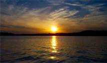
Fun times at Lake Pontchartrain
|
| Average Temperatures | Jan | Feb | Mar | Apr | May | Jun | Jul | Aug | Sep | Oct | Nov | Dec |
|---|---|---|---|---|---|---|---|---|---|---|---|---|
| Avg. High 62 | Avg. High 65 | Avg. High 72 | Avg. High 78 | Avg. High 85 | Avg. High 90 | Avg. High 91 | Avg. High 91 | Avg. High 88 | Avg. High 80 | Avg. High 72 | Avg. High 64 | |
| Avg. Low 45 | Avg. Low 48 | Avg. Low 54 | Avg. Low 60 | Avg. Low 68 | Avg. Low 74 | Avg. Low 75 | Avg. Low 75 | Avg. Low 72 | Avg. Low 63 | Avg. Low 54 | Avg. Low 47 |

 Coordinates:

