- Boat Insurance
- Boat Browser
- Boating Courses
- Boat Registration
- Boating License
-
Boating Safety
Equipment
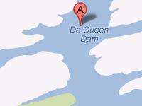
| DeQueen Lake The U.S. Army Corps of Engineers constructed this impoundment along the Rolling Fork River, creating DeQueen Lake (also known as De Queen Lake) for flood control purposes in 1977. This crystal-clear reservoir also enjoys the company of anglers, boaters, water skiers, scuba divers, and campers along the lake's 32 miles of shoreline. This lake is one of what are known as South Arkansas's tri-lakes with Dierks and Gillham Lakes. Fishing |
Search DeQueen Lake Resources |
| Boating Boaters can find six boat ramps at DeQueen Lake. Launching ramps are located in the three park areas, which also provide parking. Stay away from diving areas unless you are diving -- those locations are marked by red flags with a white diagonal stripe. Also, stay away from buoyed areas. |
|
Lodging Camping possibilities abound at DeQueen Lake, which has three campgrounds located along its shoreline. The closest state park, however, is across the state line in Oklahoma at the Beavers Bend State Resort Park. This park, located 35 miles from De Queen, provides camp sites with full hookups, a playground and restaurant, showers, swim beach, and waterfront sites. This park also is located near Hochatown State Park, and both parks are located about seven miles north of Broken Bow along Broken Bow Lake. Other lodging, such as hotels, also can be found in De Queen.
Review the Lake Resource Guide for additional lodging. Communities DeQueen Lake is located mostly in Sevier County, just four miles from De Queen, Arkansas. The closest city with a major airport is Texarkana at 54 miles from De Queen. Sevier County does maintain a public airport that offers limited service. Other towns in the area include Nashville, Dierks, and Gillham. |
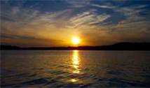
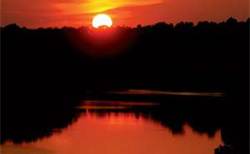
Fun times at DeQueen Lake
|
| Average Temperatures | Jan | Feb | Mar | Apr | May | Jun | Jul | Aug | Sep | Oct | Nov | Dec |
|---|---|---|---|---|---|---|---|---|---|---|---|---|
| Avg. High 53 | Avg. High 58 | Avg. High 66 | Avg. High 74 | Avg. High 81 | Avg. High 88 | Avg. High 92 | Avg. High 93 | Avg. High 86 | Avg. High 76 | Avg. High 64 | Avg. High 55 | |
| Avg. Low 29 | Avg. Low 33 | Avg. Low 40 | Avg. Low 48 | Avg. Low 58 | Avg. Low 66 | Avg. Low 70 | Avg. Low 69 | Avg. Low 62 | Avg. Low 50 | Avg. Low 40 | Avg. Low 32 |

 Coordinates:

