- Boat Insurance
- Boat Browser
- Boating Courses
- Boat Registration
- Boating License
-
Boating Safety
Equipment
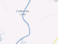
| Coffeeville Lake Coffeeville Lake is a U.S. Army Corps of Engineers reservoir on the Tombigbee River. Operated by the Corps and Alabama Wildlife and Freshwater Fisheries Division, U. S. Fish and Wildlife Service, and private operators, this lake stretches 97 miles from the dam near Coffeeville to Demopolis. Fishing |
Search Coffeeville Lake Resources |
| Boating The Army Corps of Engineers maintains a service campground that offers a boat ramp just upstream from the dam. Many anglers launch at this ramp and pass through the lock to gain access to the tailwaters below the dam. |
|
|
Lodging The 4,000-acre Choctaw National Wildlife Refuge is situated along the lower portion of Coffeeville Lake, offering campsites, a laundromat, and a boat ramp. Bladon Springs State Park also is located south of the lake and a little further south and west from the Choctaw National Wildlife Refuge. This 357-acre park also contains campsites. Grove Hill and Jackson are located about 30 minutes from Coffeeville Reservoir, and these towns provide hotels. Review the Lake Resource Guide for additional lodging. Communities Located across Clarke, Marengo, and Choctaw Counties in Alabama, Coffeeville Lake is close to many smaller communities such as Demopolis, Jackson, and Thomasville. The closest major city is Mobile, which has an airport and many accommodations. Mobile is located a little over two hours from the lake. |
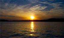
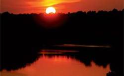
Fun times at Coffeeville Lake
|
| Average Temperatures | Jan | Feb | Mar | Apr | May | Jun | Jul | Aug | Sep | Oct | Nov | Dec |
|---|---|---|---|---|---|---|---|---|---|---|---|---|
| Avg. High 59 | Avg. High 63 | Avg. High 71 | Avg. High 77 | Avg. High 84 | Avg. High 90 | Avg. High 91 | Avg. High 91 | Avg. High 87 | Avg. High 78 | Avg. High 69 | Avg. High 61 | |
| Avg. Low 35 | Avg. Low 39 | Avg. Low 45 | Avg. Low 51 | Avg. Low 60 | Avg. Low 67 | Avg. Low 70 | Avg. Low 70 | Avg. Low 64 | Avg. Low 53 | Avg. Low 43 | Avg. Low 38 |

 Coordinates:

